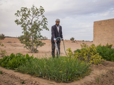
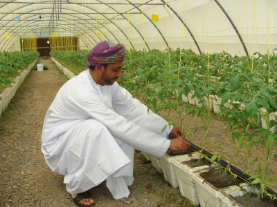
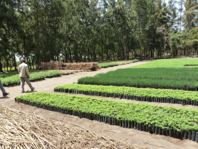
ABOUT US

The ALTOS project aims to improve water management models for rainfed and irrigated agriculture, by considering the modulation of spatial structures and connectivities induced by hydro-agricultural infrastructures and practices (e.g., modulating regional land use to drive upstream / downstream water repartition). Four study sites are considered for integrated analysis in Morocco, Lebanon and Tunisia; and two study sites are considered for methodological developments in Spain and Italy. WP1 deals with monitoring and modelling tools for characterizing spatial structures. It includes the use of innovative sensors for structure observations, and of innovative methods for data processing. WP2 addresses innovative monitoring tools for characterizing processes induced by spatial structures (.e.g, water flows). It includes several protocols relying on complementary measurements. WP3 addresses innovative modelling for simulating individual (e.g., evapotranspiration) and combined (e.g., hydrological cycle) processes. It includes multi-objectives / multi-criteria calibration procedures relying on distributed / nested measurements. WP4 simulates matter fluxes and storages for possible structure modulations, to next conduct an integrated analysis with end-users on the basis of participative seminars. It also cross-analyses irrigated and rainfed agrosystems, by addressing vulnerabilities and adaptation margins. WP5 deals with (1) the sharing of data and methods within the ALTOS consortium, and (2) the results dissemination and exploitation. For this latter item, we rely on long-term collaborations with several stakeholders (farmer associations, resource managers, engineering offices). Expected outcomes are related to SDG #2 (sustainable agriculture), #6 (water supply services), and #12 (responsible consumption and production). ALTOS contributes to PRIMA outcome indicators, including (1) newly modelling routines, (2) new irrigation technologies, and (3) innovative farming system.

For more information please visit full project website

Period of Implementation

Feb 1, 2020 - Jun 30, 2024
Total Budget

EUR 915,844.00

Project team

OUR IMPACT

Goals

ALTOS analyses the impacts of modulation scenarios on matter fluxes and storages. Therefore, ALTOS aims to pursue and achieve the following specific objectives. --> Designing innovative methodologies for monitoring, characterising and digitally representing spatial structures and connectivities, as well as designing innovative methodologies for monitoring and understanding water flows and storages driven by spatial structures and connectivities. --> Modelling water flows and storages driven by spatial structures and connectivities. The goal is to (1) design innovative models that simulate matter fluxes and storages, with implicit descriptions through equivalent parameterisations, (2) include these innovative models within integrated modelling schemes, and (3) conduct model calibrations / validations using historical time series. --> Emphasising the interest of updated modelling schemes by (1) designing modulations for spatial structures and connectivities, to be combined with changes in climate forcing, and (2) quantifying the resulting impacts on matter fluxes and storages within targeted compartments (blue and green water), on the basis of simulations from calibrated models. --> Quantifying benefits for water management by analysing scenario impacts with stakeholder having convergent / divergent viewpoints (water management authorities, agricultural development commissions, farmer associations within rainfed catchments and irrigated perimeters).

Objectives

The overall objective of the ALTOS project is to improve water management models for rainfed and irrigated agriculture, by considering the modulation of spatial structures and connectivities induced by hydro-agricultural infrastructures and practices, as an innovative tool for rational use / protection of water resources. --> We address the modulation of structures related to (1) hydro-agricultural practices (land use, heterogeneous canopies such as inter-cropping and orchards, irrigation techniques) and (2) infrastructures (water-harvesting systems such as benches and reservoirs). --> Along with spatial structures, we consider connectivities through water fluxes, including (1) surface connectivities related to surface runoff, and (2) subsurface connectivities related to infiltration and percolation. --> We assess the impacts of spatial structure modulation on first-order matter fluxes and storages, including (1) blue water compartments for artificial and natural storages (depletion and re-charge for reservoirs and aquifers), and (2) green water compartments for dependent agroecosystems (root zone water dynamics and related agricultural production). --> In a lesser extent, we study the modulation of farming inputs related to chemical treatments, and the resulting impacts on the water resources stored within surface reservoirs and aquifers.

Problems and Needs Analysis

Adaptation of water and land management is essential in the Mediterranean basin, which faces overexploitation of water / soil resources and will experience important hazards due to change in climate forcing. Meeting the growing demand for food and water requires rationales for designing innovative solutions in agricultural land use planning and practices, so that stakeholders can setup trade-offs between various needs at different levels. In the context of rainfed and irrigated agriculture, innovative solutions must aim to better collect, store, distribute and use water resources. Water resource managers are looking, among other, for decision support system tools based on the modulation of spatial structures and connectivities induced by hydro-agricultural practices and infrastructures. Existing integrated water management frameworks do not explicitly account for spatial structures and connectivities in relation to hydro-agricultural practices and infrastructures. Meanwhile, several progresses were made the last decade when addressing spatial structures and connectivities in relation to 1) their geometries and hydro-dynamical properties, 2) their influences on matter fluxes, 3) their inclusion into integrated modelling schemes and mechanistic models, and 4) their inclusion into possible evolutions of territorial water governance. Nowadays, it is necessary to sustain efforts on these progresses and to capitalise on recent advances.

Intervention Strategy(ies)

The ALTOS activities cover a three-year period and are structured into six interconnected work packages (Figure 3.1), including WP6 on management and communication. The methodological framework was elaborated by the consortium toward the best approach to address the impact of spatial structures and connectivities on matter fluxes and storages. Below are summary descriptions of the work packages. WP1 “Characterizing spatial structures” deals with innovative monitoring and modelling tools for characterizing spatial structures. It includes the use of innovative sensors with high spatial resolution and of innovative methodologies for data processing. Task 1.1 : object geometries and landscape structure [leader: IRTA]. Task 1.2 : landscape featuring [leader: LARI]. WP2 “Monitoring fluxes and storages” addresses innovative monitoring tools for characterizing matter fluxes and storage driven by spatial structures. It includes innovative experimental protocols that rely on the joint use of complementary measurements. Task 2.1 : water and chemical fluxes [leader: CERTE]. Task 2.2 : spatial heterogeneities [leader: CESBIO]. WP3 “Modelling fluxes and storages” uses outcomes from WP1 and WP2 to address innovative modelling for simulating individual (e.g., evapotranspiration) and combined processes (e.g., combined hydrological cycle and crop functioning). It includes calibration procedures that rely on distributed and nested measurements to simultaneously calibrate several model parameters. Task 3.1: modelling individual processes [leader: UNICA]. Task 3.2: modelling combined processes [leader: INAT]. WP4 “Simulating fluxes and storages for structure modulations” combines outcomes from WP1 and WP3 to simulate matter fluxes and storages for possible structure modulations. Obtained simulations are translated into indicators for integrated analysis with stakeholders during participative seminars (see table below). WP4 also includes a cross-analysis for irrigated and rainfed agrosystems, by comparing vulnerabilities and adaptabilities on the basis of indicators related to water availability and agricultural yield. Task 4.1: setting up scenarios [leader: UCAM]. Task 4.2: impact assessment and scenario ranking [leader: INRGREF]. WP5 “Pooling, dissemination and exploitation” conducts pooling of data and methodologies between project partners and throughout project duration, by using several means such as dedicated platforms, workshops, mobilities. WP5 is also in charge of the dissemination and exploitation of the project results according to the type of outcome and target audiences (see Table 2.2 in Section 2) Task 5.1: sharing of data and methods [leader: CNRS-L] Task 5.2: dissemination and exploitation of project results [leader: INRGREF]. WP6 “Coordination, management and communication”. Task 6.1: Coordination and Management [Leader: LISAH]. Task 6.2: Communication [Leader: LISAH].

Impact Pathway

The ALTOS strategy for result dissemination and exploitation relies on (1) community facilities (i.e., international laboratories, observatories, and modelling platforms), (2) open access to project results, and (3) pro-active knowledge transfer to key target groups such as policy makers, academics and engineering offices. Through the community facilities, most of which include statutory user committees, the project benefits from historical collaborations with several stakeholders involved in policy making about water / soil conservation and agricultural development. These community facilities, which will continue beyond the end of the ALTOS project, also permit to ensure that measures are effectively implemented after the project. The ALTOS project aims to advance scientific knowledge for improving water resource management within rainfed and irrigated agrosystems. Consequently, stakeholders involved in this thematic are the end-users of the project, and they are the key targets for dissemination / exploitation activities. Seven main groups are identified. --> National and regional directorates for agricultural development that are already involved in the community facilities in Tunisia (DG-RE, DG-BGTH, DG-PA, DG-ACTA and CRDA), in Morocco (ORMVAH, ABHT) and in Lebanon (Litani Authority). --> Farmer, water user association and NGOs in the field of rural development: GDAs and ADUTAR in Tunisia, Baalbeck NGO in Lebanon. The ALTOS project liaises with donors who support farmer associations and NGOs. Thus, it attends workshops organized by French Agency for Development who supports rural organizations and NGOs in Morocco, Tunisia and Lebanon. --> Engineering offices: SCET Tunisia, ENVILYS. --> Think tanks: as indicated at the opening of the second edition of the summit of African think tanks, Mediterranean countries pay particular attention to the development of think tanks as an integral component in the quest for sustainable development. Through IRD, ALTOS is connected with Institute for Sustainable Development and International Relations (IDDRI) and its Mediterranean program "Nature-based solutions in the Mediterranean region". --> Regional and international organisations: ALTOS is in line with the fourth priority of ICARDA (International Centre for Agricultural Research in the Dry Areas) 2017-2026 strategic plan "Develop innovative approaches to water, land, and soil resource management that address water scarcity, enhance soil health and productivity, and contribute to land degradation neutrality", and plans knowledge exchanges with ICARDA. Also, most partners of the ALTOS consortium work with an International Centre for Advanced Mediterranean Agronomic Studies (CIHEAM). --> Academics: scientific community and students: each ALTOS partner is affiliated with a university and is involved in training and student mobility. Subsequently, the knowledge management strategy conducts a panel of specific actions to transfer the ALTOS results towards the targeted stakeholders. The panel of these specific actions includes (1) online data delivery through existing information systems, (2) publications, (3) training sessions, (4) methodological transfers though application programs, online dedicated hubs and user manuals, (5) reports from participative seminars, and (6) policy briefs.

Note: if you need to move a link detach it and re-link it again

links budget to project work package
links work package to another work package
links work package to research outcome
links outcome to SDG
links research outcome to development outcome
links research or development outcome to IDO
links work package to development outcome
links SDG to target
Zoom

NEWS & EVENTS