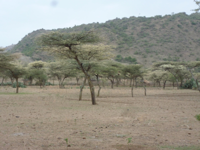
ABOUT US

The up and out scaling of a technological innovation are driven by its suitability for specific farming system. These systems are defined by a complex interaction of climatic factors, and socio-economic considerations. Hence, in the optic of enhancing digital services to manage and reduce the impact of variable weather and extreme events, it is then critical to define these farming systems and their geographical distribution. In turns, such an information can later be used to inform policies, programming and investment decisions. The decision of adopting a given farming system in the Sahel is mostly driven by the climatic conditions affecting the farm, with the availability of moisture at specific times being a primary factor influencing this decision. Therefore, mapping the climatic factors affecting the cultivation of crops is a reliable proxy to predict the distribution of farming systems, especially if these are then linked to socio-economic considerations and validated on the ground at community level. This evidence-based approach can then be used to help determine the climate services that would benefit farmers and farming systems (including businesses, and other food and land system actors) to strengthen their resilience and adaptive capacity to climate-related hazards and natural disasters.

Period of Implementation

Oct 1, 2021 - Dec 15, 2021
Total Budget

USD 136,000.00

OUR IMPACT

Goals

Defining the climatic factors affecting the cultivation of two crops, and then map these factors based on downscaled climatic datasets, to ultimately define the farming systems matching the main production types.

Objectives

1.1.1 Recovery in a centralized repository the available agronomic dataset for rice and wheat from the major research stations in Senegal from various institutions; 1.1.2 Recovery in a centralized repository the climatic and soil dataset for Senegal from various institutions; 1.1.3 Define additional potential sites needed to improve climatic modeling; 1.1.4 Data analysis by multiple regression to define climatic factors affecting the crop performances, and the suitability boundaries; 1.2.1 Geographical mapping of the climatic suitability boundaries to define the distribution of the farming systems; 1.3.1 Define 20 random GPS locations within these defined farming systems to conduct visits for validations ; 1.3.2 As part of these visits, define the socio-economic and management conditions of the local communities; 1.4.1 Plan with these communities sets of innovations for testing and validation;

WHERE WE WORK

RESOURCES

Addressing SDG15 in the Sahel by Building Pathways for Transforming Food and Land Systems in a Climate Crisis

Author(s): Filippo Maria Bassi | Amadou T. Sall | Hafssa Kabbaj | Ajit Govind

Date: 2021-12-14 | Type: Report - Sub-type(s): Internal Report, Donor Report

Rainfed rice systems in Senegal: Vulnerable systems but with a great potential for food security in the context of climate change

Author(s): I Ali | K Saitod | Benoit Clerget | Myriam Adam | N Sirdev | Paricio Mendez del Villar | Julian Ramirez-Villegas | Bertrand Muller | A Heinneman | Alain Audebert | Maria C. Rebolledo | Maria C. Rebolledo

Date: 2021-12-14 | Type: Report - Sub-type(s): Internal Report

Agronomic data on Durum Wheat from Senegal multi location trials 2016-2020

Author(s): Amadou T. Sall | Hafssa Kabbaj | Ajit Govind | Filippo Maria Bassi

Date: 2021-12-07 | Type: Dataset - Sub-type(s): Crop Yields in Field Experiments

Senegal climate data from 2010 to 2020

Author(s): Ajit Govind | Hafssa Kabbaj | Amadou T. Sall | Filippo Maria Bassi

Date: 2021-12-07 | Type: Dataset - Sub-type(s): Other (Climatic Data)